7C - Pine Mountain Belt
Click on maps below to view larger individual images
 |
 |
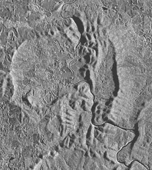
| Pine Mountain SLAR (Side-Looking Airborne Radar) |
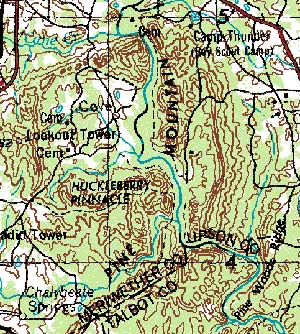
Pine Mountain Topographic Map |
(Topo Map) |
Harris County |
(1938) |
(1964) |

|

|
||
(Topo Map) |
(NALC) |
(SLAR) |
|

|
Rationale:
Pine Mountain is a forested ridge in west-central Georgia located 70 miles (113 km) southwest of Atlanta and 20 miles (32 km) north of Columbus. The ridge stretches between the Chattahoochee and the Flint rivers and is both a topographically and geologically unique feature. The mountain displays several geologic structures that help answer the question “Why are there mountains here?” The area also has a human history that spans important parts of both the nineteenth and twentieth centuries. The site is strongly connected to the life and politics of President Franklin D. Roosevelt, as the Warm Springs resort served both as health spa for the President and as a rural retreat from the stresses inherent in political leadership. Roosevelt spent so much time at Warm Springs that it eventually became known as the “Little White House.” The Pine Mountain region also features several depression-era farms that participated in the Federal Pine Mountain Valley Rural Community Project. The town of Pine Mountain also offers the botanical wonders of Callaway Gardens.Themes
|
Content Outline
|
Activity TitlesAll activities include
|

|

