

|
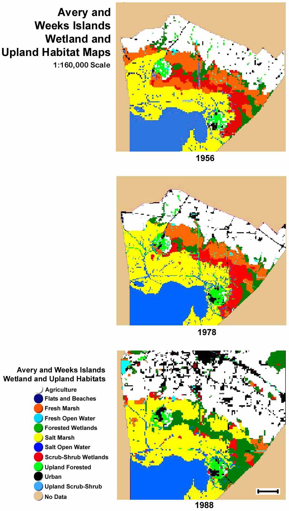
Wetland and Upland Habitat Maps Data Source: USGS National Wetlands Research Center NASA/USL Regional Application Center RAC 980012 and RACP990053 Scale Bar = ~2.5 mi or 4.1 km Click for Larger Image
Use your browser's Back button to |
|
|
Wetland and Upland Habitat Maps Data Source: USGS National Wetlands Research Center NASA/USL Regional Application Center RAC 980012 and RACP990053 Scale Bar = ~2.5 mi or 4.1 km Click for Larger Image
Use your browser's Back button to |
|