|
||||
Columbia |
|
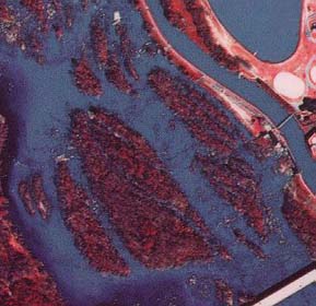
Portion of infrared aerial photograph of the Congaree River bordering downtown Columbia (1981). |
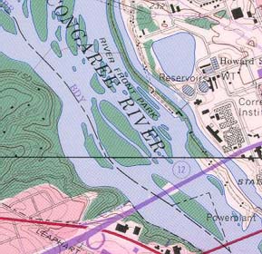
Portion of Columbia North and SW Columbia USGS quadrangles (1990 and 1982) (above and below the black line). |
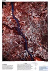
Columbia (NAPP)
|
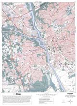
Columbia (Topo)
|
RationaleColumbia is in the geographic center of the state, and it was selected as the capital city primarily because it was the junction point of two major rivers, the Broad and Saluda, which made it accessible to a large number of South Carolinians. The Columbia study site is unique, as it is geographically situated on three different geological regions, the Piedmont, the Sandhills, and the Coastal Plain. The Piedmont band of rolling topography runs in the northeast- southwest direction and is bounded by the Sandhills Region. Today, Columbia, like other urban and suburban metropolitan cities in South Carolina, needs services and resources to support its large population and busy economy. Water, electricity and natural gas are needed for both industrial and residential use. Transportation facilities such as airports, highways, and railroads are needed to link the people and resources. Space and land are needed for housing, businesses, factories, shopping centers, and utility corridors in urban areas. Specifically, Columbia is fully supported by the surrounding landscape, including forest land for timber, agricultural land for row crops and dairy products, and mining sites for building materials. Careful attention must be paid to the possibility of over-stressing the available resources of these areas. |
Background InformationDescription of Landforms
Influence of Topography on Historical Events and Cultural Trends
Natural Resources, Land Use, and Environmental Concerns
|