9C - Georgia Coastal Corridor
Click on maps below to view larger individual images
 |
 |
| Altamaha River Estuary, Satellite Image |
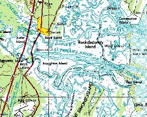
Altamaha River Estuary, Topographic Map |
(NALC) |
(1998) |
(1734) |

|

|

|
(Topo Map) |
(ERTS) |
|

|

|

|
Rationale:
The Georgia Coastal Corridor is a mix of thriving port cities, undeveloped barrier island seacoasts, and an agricultural history that goes back to the times of Native Americans. The cities of Savannah and Brunswick are major shipping centers with a historic past while the Gullah culture of the Sea Islands preserves a unique African American heritage. The Okeefenokee Swamp is a peat-filled wetland that is known as the largest blackwater swamp in North America and is home to an amazing variety of wildlife. Cumberland Island is one of the world’s largest undeveloped barrier islands, providing habitat for sea turtles and alligators.
The area around Darien and the Altamaha River was ideal for rice cultivation and was the center of the coast’s plantation economy until the Civil War. The Altamaha River flows through some of the South’s last remaining bottomland hardwood forests, cypress swamps, and tidal marshes containing over a hundred species of rare plants and animals. Several historic forts along the Georgia coast have been restored.
Themes
|
Content Outline
|
Activity TitlesAll activities include
|

|

