8D - Mississippi River Alluvial Plain
Click on maps below to view larger individual images
 |
 |
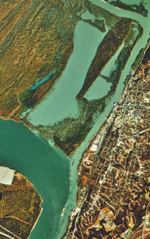
| Mississippi River at Vicksburg, Aerial Photograph |
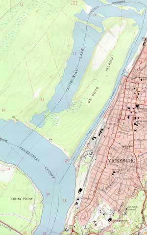
Mississippi River at Vicksburg, Topographic Map |
(NALC) |
of Eastern Mississippi |
(NAPP) |
|

|

|

|
|
(Topo Map) |
(Topo Map) |
(Topo Map) |
|

|

|

|
Rationale:
The Mississippi River was the major transportation route for the central part of North America during the period of exploration and settlement. As the river changed its course over and over again, a broad alluvial plain developed with very fertile soil deposited by the river during times of flood. Because of the rich soil and convenient river transportation, many plantations and towns were established along the river. The end of slavery and the associated Plantation Era after the Civil War did not change life very much for many of the small farmers in the region who then became sharecroppers on the same land. Many of these tenants later emigrated to northern cities to work in factories. This region is also known as the home of the ‘blues’, a style of Black music that eventually entered the mainstream.
The city of Vicksburg is located on bluffs along the Mississippi River at the southern tip of the "Delta.” The bluffs made the city easy to defend and gave it protection from floods. During the Civil War, control of Vicksburg was a major goal of the Union. In 1863, Confederate troops withstood a 47-day siege before surrendering to General Ulysses S. Grant.
Themes
|
Content Outline
|
Activity TitlesAll activities include
|

|

