|
||||
Winyah Bay |
|
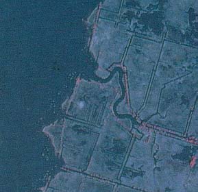
Portion of NHAP infrared photograph (1983) of Winyah Bay. |
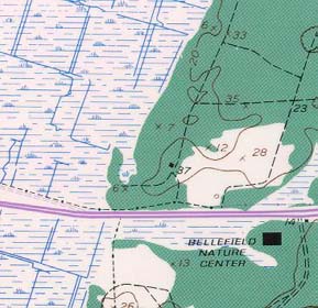
Portion of topographic map from USGS North Island quadrangle.(1973). |
Winyah Bay (NAPP)
|
North Inlet (Topo)
|
RationaleThe coastal bays, inlets, salt marshes, and estuaries of South Carolina have become an ever-increasing attraction to vacationers, photographers, anglers, hunters, and naturalists, because the landscape is so different from the inland areas. The Winyah Bay area contains examples of pristine tidal flat and salt marsh environments as well as the remnants of rice fields and other historical land uses. The remnants of once thriving plantations provide an understanding of a long discarded way of life. The estuary itself is a breeding ground for many sea creatures. Estuaries provide an abundant food supply for fish and shellfish, offer excellent habitat for waterfowl and other wildlife, serve as a filter for pollution, and furnish a protective barrier against storms from the ocean. Winyah Bay also borders the port city of Georgetown, which even today plays a major role in the economy of the Coastal Zone. |
Background InformationDescription of Landforms
Influence of Topography on Historical Events and Cultural Trends
Natural Resources, Land Use, and Environmental Concerns
|