|
||||

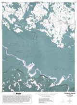
Congaree Swamp |
|
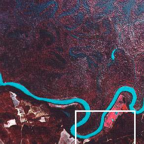
Portion of image from NAPP infrared photograph of Congaree Swamp (1980). Area shown in the map is outlined. |
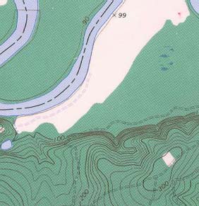
Portion of topographic map From USGS Gadsden quadrangle (1982). |
Congaree Swamp (NAPP)
|
Congaree Swamp (Topo)
|
RationaleThe Congaree Swamp Study Site serves as an outstanding example of a pristine river bottom floodplain forest similar to those which used to occur along many of the old meandering rivers draining South Carolina's Coastal Plain Region. These relatively flat floodplain areas are havens for anglers, hunters, research biologists, and naturalists. River bottom floodplains not only provide excellent habitat for wildlife but also serve several ecological functions such as flood control after heavy rains, ground water recharge, and a limited amount of pollution filtration. In spite of Hurricane Hugo's destruction, Congaree Swamp still contains the oldest significant stand of old growth floodplain hardwood forest in the country, with a number of "record trees" (largest on record for the species). Most of the big trees are at least 200 years old, and much of the site is in a pristine condition. In all, more than 90 species of trees can be found within the swamp boundaries as well as a number of threatened and endangered species. |
Background InformationDescription of Landforms
Influence of Topography on Historical Events and Cultural Trends
Natural Resources, Land Use, and Environmental Concerns
|