 |
||||
Lake Marion |
|
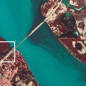
Portion of NHAP infrared photograph of Lake Marion (1983). Outlined section is shown in the map to the right. |
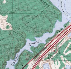
Portion of topographic map From USGS Vance Quadrangle (1979). |
Lake Marion (NAPP) |
Lake Marion (Topo) |
RationaleThe Lake Marion study site highlights unique rock exposures, significant historical sites, and land use characteristic of a tourist-based economy. The Santee Limestone is an important Coastal Plain rock formation. It is exposed at the surface only in the south-central part of the state in the Lake Marion vicinity, even though it is buried beneath other sedimentary rocks throughout a much larger area. The formation tilts gently towards the Atlantic Ocean. The Santee Limestone is significant because it is the major aquifer or water producing unit for most Coastal Plain wells. Also, its occurrence around Santee has allowed the development of the only major area in South Carolina featuring Karst topography. A further attraction of the Lake Marion area is the Santee National Wildlife Refuge, a wintering area for migratory birds such as Canadian geese, pintail and mallard ducks. Fort Watson, the Indian Mound that was the site of Francis Marion's skirmish with the British is located in this area. These features provide the geological, environmental, and historical significance of the site. |
Background InformationDescription of Landforms
Influence of Topography on Historical Events and Cultural Trends
Natural Resources, Land Use, and Environmental Concerns
|


