

|
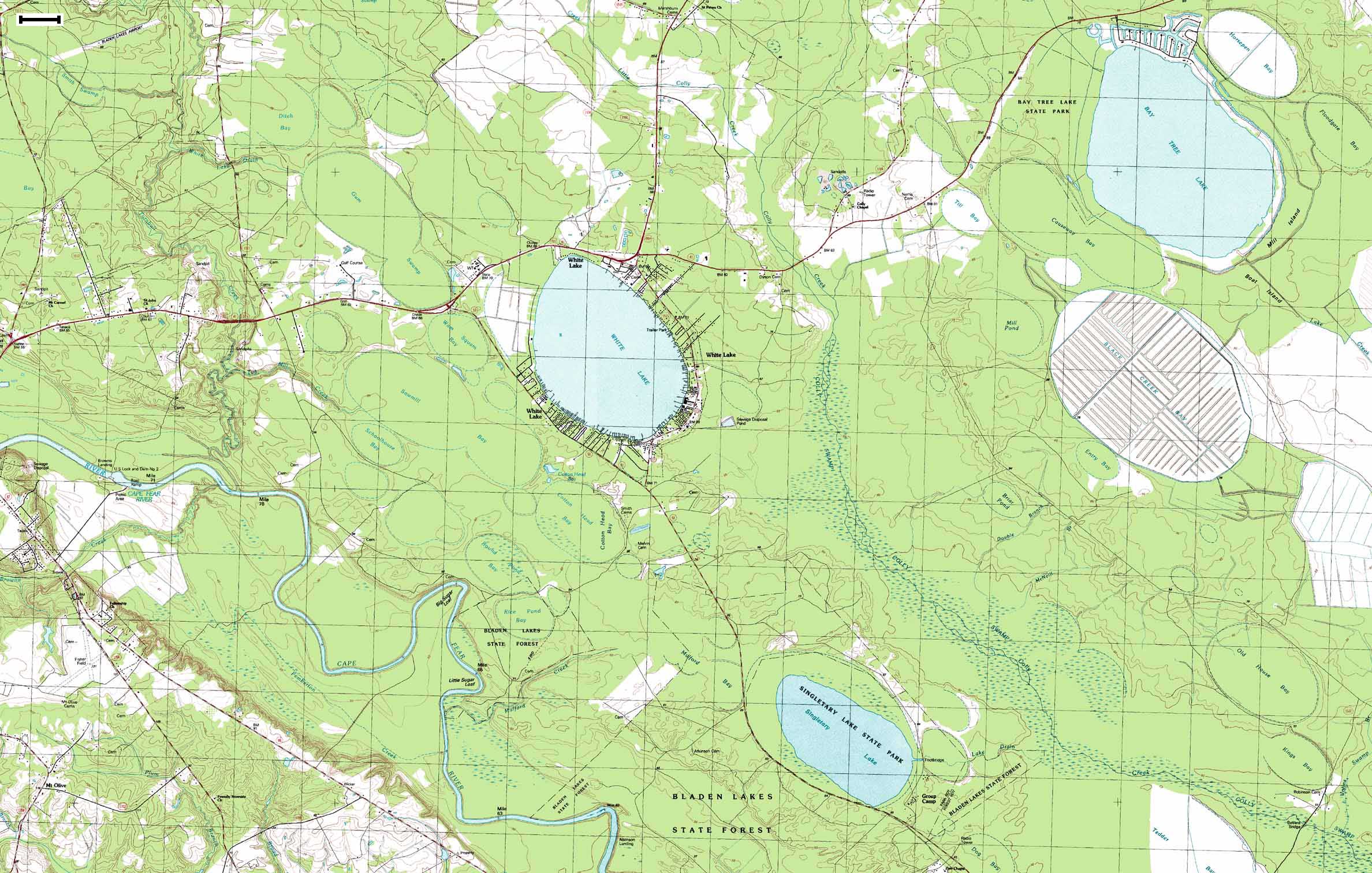
(Topo Map) Data Source: Singletary Lake - 1986, White Lake - 1986, Elizabethtown North - 1987, and Elizabethtown South - 1987 USGS 1:24,000 Quadrangles Scale Bar = ~0.38 mi or 0.61 km |
33 X 21" 473.5 M, 169 sec at 28.8 Kbps Use your browser's |
|
|
(Topo Map) Data Source: Singletary Lake - 1986, White Lake - 1986, Elizabethtown North - 1987, and Elizabethtown South - 1987 USGS 1:24,000 Quadrangles Scale Bar = ~0.38 mi or 0.61 km |
33 X 21" 473.5 M, 169 sec at 28.8 Kbps Use your browser's |
|
|