 |
||||
Graniteville |
|
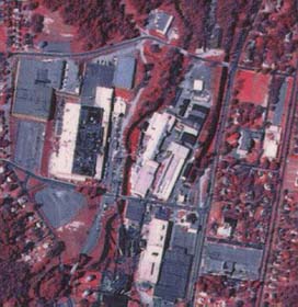
Portion of NAPP infrared photograph of old textile mills in Graniteville (1989).. |
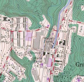
Portion of Graniteville USGS quadrangle (1980). |
Graniteville (NAPP) |
Graniteville (Topo) |
RationaleThe Graniteville Study Site highlights a typical mill town along the boundary between the Sandhills and the Piedmont regions of South Carolina. The textile mills which developed in and near Graniteville relied on water power for running the machinery and required both the damming up of streams to create small reservoirs and the construction of a canal system for delivering water to the factory site. Ponds were also constructed to handle wastewater from the plants. Often this water was polluted with a variety of hazardous wastes. The Langley Pond Superfund Site in Graniteville is a prime example of the types of environmental problems which can result from improper disposal of industrial waste. Public access areas are located along the reservoir north of town and along Langley Pond south of the old mill site. Kaolin mining is also a major industry in the Graniteville area. Some of the abandoned mines are now used for landfills, and site restoration is a major concern. |
Background InformationDescription of Landforms
Influence of Topography on Historical Events and Cultural Trends
Natural Resources, Land Use, and Environmental Concerns
|


